 |
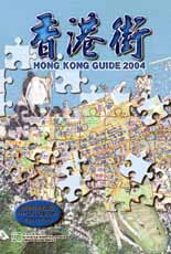
| Bird's eye view: The Hong Kong Guide 2004 Photomap Edition, the first of its kind, is available for sale starting from March 29. |

|
The Lands Department's Survey & Mapping Office has published the Hong Kong Guide 2004 Photomap Edition, the first of its kind available in the market.
A photomap combines line map data with symbols and texts on top of aerial photograph imagery, the Survey & Mapping Office says.
The background aerial photographs are taken at an altitude of 8,000 feet.
The photo imagery is also digitally retouched for clarity with a consistent tone and better quality.
The guide, with map data updated to November, 2003, provides readers with a more realistic bird's-eye view of the terrain together with useful map details and descriptive information.
As the photomaps look closer to reality, readers may find it easier to interpret the features. It is also a good reference for real estate with a bird's-eye view of the surroundings.
Readers will be surprised by the beauty of the green areas all over Hong Kong that cannot be directly seen on traditional maps, the Survey & Mapping Office said.
The guide contains about 170 pages of photomaps in different scales covering the whole of Hong Kong.
Some ground features are obscured since there are so many highrises in Hong Kong. Forty-two pages of conventional line maps are included to supplement the photomaps of the densely populated areas.
Starting from March 29, the 408-page Hong Kong Guide 2004 Photomap Edition will be available for sale at all Survey & Mapping Office map sales counters at $100 per copy.
Details of the counters can be browsed here. Questions? Please call 2231 3187 or 2780 0981.
The new guidebook is also available at designated post offices, selected bookstores and Online Government Bookstore of ESDlife.
Go To Top
|


