|
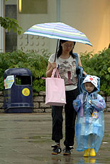
| Wet wet wet: The year 2005 was the third wettest on Hong Kong's record, with a total rainfall of 3,214.5mm - 45.2% above normal. |
The year 2005 was the third wettest on Hong Kong's record, with a total rainfall of 3,214.5mm - 45.2% above normal, the Hong Kong Observatory says.
This was mostly due to an active southwest monsoon in June and August, bringing in plenty of moisture. June was the fourth wettest since records began in 1884, and August the second wettest. The rainfall in these two months alone amounted to 1,865.2mm, about 84% of the normal annual rainfall.
While an unprecedented 26 named storms occurred in the northern Atlantic in 2005, compared with a norm of about, low tropical cyclone activity was seen in the western North Pacific and the South China Sea, where only 26 tropical cyclones formed, compared with the normal of 31.
Three tropical cyclones affected Hong Kong in the year, roughly half the normal figure. The first tropical cyclone warning signal of the year was issued on August 12, the latest in post-war years.
Hazy year
2005 was also a hazy year. For 27.8% of the time, reduced visibility of 8km or below was observed at the airport, breaking the previous record of 23.6% set in 2004. Despite a very wet June and August, below normal rainfall and hence a lack of washout processes was recorded in many other months, contributing to more frequent occurrences of haze.
January was drier than normal. With haze occurring on most of the days in the month, the number of hours of reduced visibility observed at the airport reached an all-time high of 484 hours.
February was gloomier and more humid than usual. The monthly mean relative humidity of 86% was the fourth highest for the month.
March and April were drier than usual. With the monsoon trough lingering near the south China coast, May's weather was marked by heavy rain, active thunderstorms and severe squalls.
Stormy May
The Amber Rainstorm Warning was issued seven times in May, a new record for the month since the warning system was introduced in 1998. During a rainstorm on May 9, severe gusts with speed reaching 135km per hour toppled stacked containers at terminals in Kwai Chung and Tsing Yi, resulting in one death and two injuries. There were also more than 100 reports of fallen trees and scaffoldings in different parts of the city.
Very wet weather continued in June. A total of 893.9mm of rainfall was recorded, more than double the normal monthly figure of 376mm. The first Red Rainstorm Warning of the year was issued during a torrential rainstorm on June 24.
July was warmer and sunnier than normal. There were reports of hail in Tsing Yi on July 21 amid severe squally thunderstorms.
Wetter August
August was much wetter than normal. The total rainfall was 971.3mm, almost 2.5 times the normal figure of 391.4mm. The Standby Tropical Cyclone Warning Signal No 1 was issued for the first time in the year on the approach of Severe Tropical Storm Sanvu.
September was marked by the hazy weather associated with the relatively weak northeast monsoon and distant tropical cyclones east of Hong Kong. The number of hours of reduced visibility observed at the airport reached 237 hours in the month, the highest for September since records began in 1997.
The Standby Signal No 1 was issued during the approach of Tropical Storm Vicente on September 17. On September 24, Typhoon Damrey necessitated the issue of the first and only Strong Wind Signal No 3 in the year.
October and November were drier and much warmer than normal. The mean minimum temperature of November was 21.4 degrees Celsius, the same as the high record set in 1998.
December was cooler and drier than normal, with frost reported in the New Territories on December 23.
|